
Map
Digitize farms, field boundaries, and geotagged records.
Our Platform
Digisaka brings together farm mapping, crop analytics, AI-assisted agriculture, and MRV-ready workflows for agricultural teams and stakeholders.
Connected Platform
The platform supports smarter agricultural operations by combining remote sensing, geospatial information, digital records, and decision-support tools in one connected ecosystem.
Digitize farms, field boundaries, and geotagged records.

Read crop health, weather, and satellite signals over time.

Use AI and field evidence to spot pest, disease, and climate risk.

Send recommendations, alerts, and program-ready reports faster.
Platform Capabilities
Each capability connects field teams, farm records, satellite data, and decision support into a practical workflow.
 WebGIS Layer
Track crop condition, farm boundaries, and field activity through satellite-backed geospatial monitoring.
 NDVI + Drone
Use drone, vegetation, and crop analytics to guide better recommendations and smarter interventions.
 AI Assistant
Support field teams with AI-assisted crop image analysis for pest, disease, and plant-health signals.
 MRV Ready
Enable AWD, low-carbon rice programs, sustainability monitoring, and MRV-ready reporting workflows.
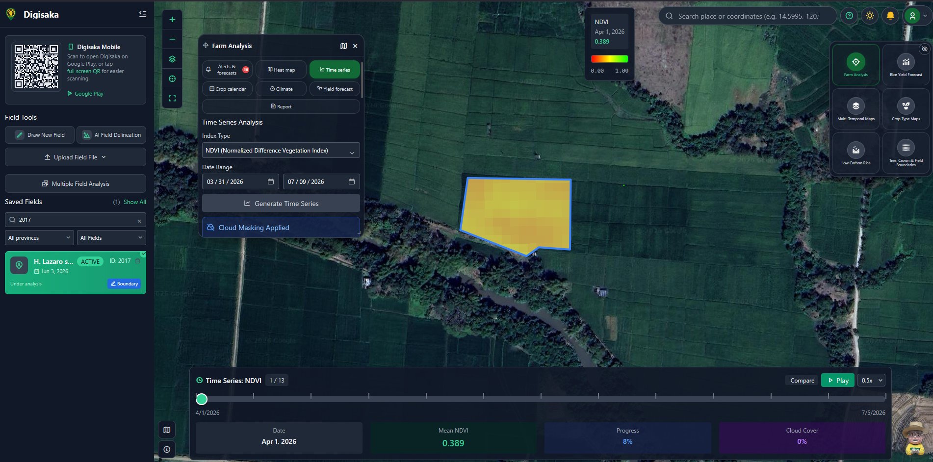 Command Center
Centralize interactive maps, saved fields, field layers, and analytics in a command center for agriculture teams.
 AI Buddy
Give farmers and technicians a friendly AI support layer for smarter field decisions and practical next steps.
Ready for smarter agriculture?